What Hike Shall I Take?
Bob Gore
Overview of the Trails in the Ivy Creek Natural Area
Times are for leisurely walks. See the map of the natural area for locations. There are benches situated at intervals along the trails.
TRAILS STARTING NEAR THE BARN:
PAVED TRAIL 0.6 miles, 10 minutes
The Paved Trail begins and ends in the parking lot, and loops around the barn area. Be sure to check out the displays in the kiosk! It is asphalt, level, though somewhat uneven, good for strollers or wheelchairs. It is partly wooded, partly open. It crosses through the birdwatching area and the pollinator garden.
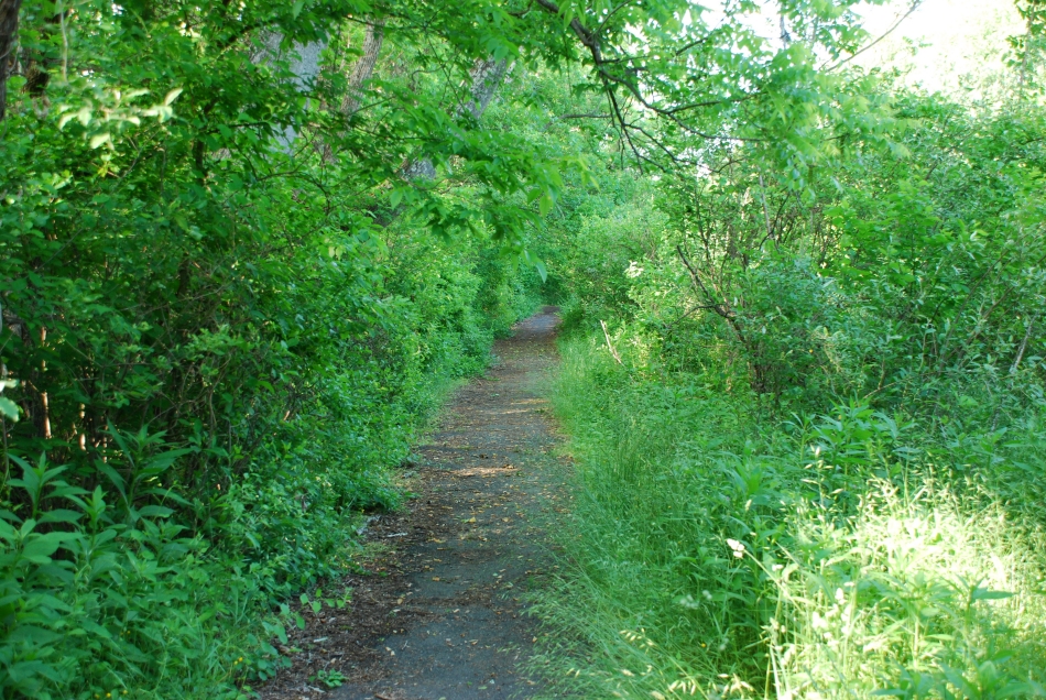
RED TRAIL 1.6 miles, 1 hour
The Red Trail is the main circuit loop with connections to all the other trails except the Field Trail. Starting at the barn, the trail goes left at the first intersection with the Blue Trail to pass a pile of broken jars and dishes from the River View Farm era. Conly Greer supplemented his income as an extension agent and farmer by getting up early before his other work and hauling trash to this site from UVA and from the former Monticello Hotel. It then switchbacks to help manage the steep downhill to Martin’s Branch Creek. From there, the trail curves to the right past a side-branching boardwalk to the water’s edge and proceeds (bearing left at the boardwalk) to skirt the bank of the reservoir until it turns steeply uphill to a major intersection. Crossing the intersection, the Red Trail continues through fields and woods to a second intersection, and continues through woods alongside an old rock wall – see information in box at the intersection with the Orange Loop Trail. From the information box, the trail descends to a bridge over a creek with a barred owl nesting box visible nearby. It proceeds along gentle slopes through fields and woods, eventually paralleling the creek, crossed over via a railed bridge. Finally, it leads to wooden steps, and, bearing right, through beech woods back to the parking lot and the barn.
WHITE TRAIL 0.1 miles, 5 minutes
The White Trail follows the ridge of the creek valley through beech woods. The trail is fairly level until it descends to the creek at one end.
SCHOOL TRAIL 0.2 miles, 40 minutes INCLUDING STOPS!
The School Trail is a self-guided instructional walk with explanatory printouts corresponding to a variety of labelled trees and bushes. The printouts can be found in the boxes at the two ends of the trail or you can download your own copy from the Ivy Creek website. If you use the laminated Ivy Creek copy, please put it back in one of the boxes when you complete your tour!
BLUE TRAIL / FIELD TRAIL LOOP 0.4+ miles, 15 minutes
The Blue Trail is a steep downhill to a bench at the edge of the reservoir. It is wooded and shady except for the connecting Field Trail loop. The trail passes the site of an old farm spring.
FIELD TRAIL 0.6 miles, 20 minutes
An open, sunny walk. From the butterfly garden, bear right along the field edge. At the northern end of the field, the trail forks: left for a shortcut along the edge, right through the woods past a branching side trail leading to benches and an information box about the village of Hydraulic Mills which was flooded in the construction of the reservoir. There is also information about the village of Hydraulic in the kiosk. The Field Trail intersects with the Blue Trail at several junctures.
TRAILS STARTING SOME DISTANCE FROM THE BARN:
BROWN TRAIL 0.3 miles
The Brown Trail is a short, forking (“Y-shaped”) connector to the two major intersections on the Red Trail.
PENINSULA TRAIL 0.6 miles, 25-30 minutes, plus 15 minutes to and 15 minutes from the trailhead
Starting at the intersection with the Red Trail, the Peninsula Trail, a wooded walk with sunny patches, descends to cross the Orange Trail, then ascends to an information box. From there it is fairly level, looping a narrow peninsula through gorgeous groves of mountain laurel. There is evidence of beaver activity along the trail. There are benches and branching side trails to benches at the water’s edge at frequent intervals.
ORANGE TRAIL 1.2 miles, 40-45 minutes plus 15 minutes at both ends to and from trailheads
The Orange Trail, wooded and shady from beginning to end, is Ivy Creek’s most vigorous walk. From the Red Trail intersection with the Peninsula Trail, the Orange Trail curves downhill to a bench at the edge of the reservoir. From there, it crosses the Peninsula Trail and continues to wind uphill, with steep stretches, for a considerable distance. It levels out at the top to where it reconnects with the Red Trail and the Brown Trail. Note the side-branching Orange Loop Trail before you reach the intersection (see map).
SOUTH FIELD TRAIL / PAVED TRAIL LOOP 0.4 miles, 20-25 minutes
From the parking lot, bear left at the guide post. A mostly open, sunny walk, the South Field Trail connects with the Paved Trail to loop back to the parking lot. Bear right at the Red Trail / Yellow Trail intersection, pass the School Trail on the left, bear left at guide post to continue the South Field Trail / Paved Trail loop.
YELLOW TRAIL 0.4 miles, 15 minutes, plus time to and from trail heads
The Yellow Trail runs through woods sloping gently upwards (if you start near the parking lot) to follow the ridge of a small ravine with a creek running along the bottom.
GREEN TRAIL 0.6 miles, 30 minutes, plus time to and from trailheads
A narrower trail, through mostly open beech woods. It may be obscured by fallen leaves in late fall and winter. It climbs some steep slopes. At one end, it follows a creek; at the other end, it cuts through a holly grove. It descends to a pawpaw grove near the footbridges at its lowest point.